https://github.com/briochemc/oceanbasins.jl
Determine if a (lat,lon) coordinate is in a given ocean basin
Science Score: 13.0%
This score indicates how likely this project is to be science-related based on various indicators:
-
○CITATION.cff file
-
✓codemeta.json file
Found codemeta.json file -
○.zenodo.json file
-
○DOI references
-
○Academic publication links
-
○Committers with academic emails
-
○Institutional organization owner
-
○JOSS paper metadata
-
○Scientific vocabulary similarity
Low similarity (11.2%) to scientific vocabulary
Keywords
Keywords from Contributors
Repository
Determine if a (lat,lon) coordinate is in a given ocean basin
Basic Info
Statistics
- Stars: 7
- Watchers: 2
- Forks: 0
- Open Issues: 0
- Releases: 10
Topics
Metadata Files
ReadMe.md
OceanBasins.jl
A set of simple functions to determine which ocean basin a (lat,lon) coordinate is in.


OceanBasins.jl essentially provides functions to algorithmically determine if a (lat,lon) coordinate lies in a specific ocean or sea. (It was developed to mask regions of interest for my personal research endeavours, i.e., global marine biogeochemical modelling with AIBECS.jl.)
Usage
To load the ocean/sea polygons, start with
julia
OCEANS = oceanpolygons()
Note that the first time you call oceanpolygons(), it will download the Limits of oceans and seas in digitized, machine readable dataset and store it in a safe place using DataDeps.jl.
You can then test if a given lat,lon coordinate is, e.g., in the Pacific, via
julia
ispacific(lat, lon, OCEANS)
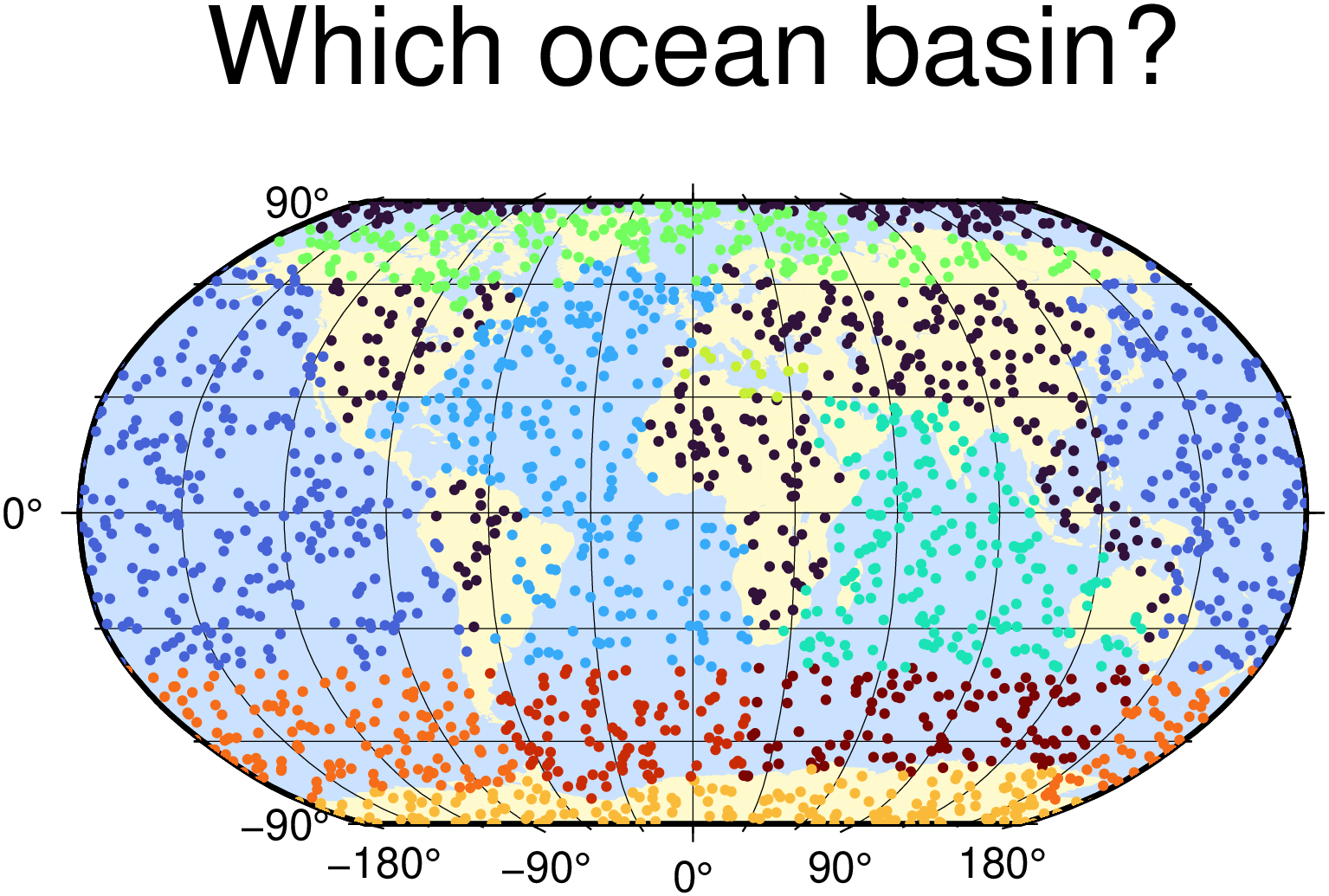
The image at the top was produced by using ispacific-like functions (and GMT.jl for the plotting):
julia
using Libdl
push!(Libdl.DL_LOAD_PATH, "/usr/local/Cellar/gmt/6.0.0_5/lib")
using GMT
coast(region=:d, proj=:Robinson, frame=:g, res=:crude, area=10000, land=:lemonchiffon1, water=:lightsteelblue1, figsize=12)
using OceanBasins
const OCEANS = oceanpolygons()
N = 2000
lons = 360rand(N) .- 180
lats = 180rand(N) .- 90
isocns = [ispacific, isatlantic, isindian, isarctic, ismediterranean, isantarctic] # <- these functions
colors = [sum(iocn * isocns[iocn](lat,lon,OCEANS) for iocn in 1:length(isocns)) for (lat,lon) in zip(lats,lons)]
scatter!(lons, lats, title="Which ocean basin?", marker=:c, size=0.1, zcolor=colors, show=1, savefig="demo.png")
I made this package for myself so it likely has some bugs. PRs welcome!
Warning
This package does not determine if a coordinate is on land. This is because the polygons from the Limits of oceans and seas in digitized, machine readable dataset overlap with land. For example, this
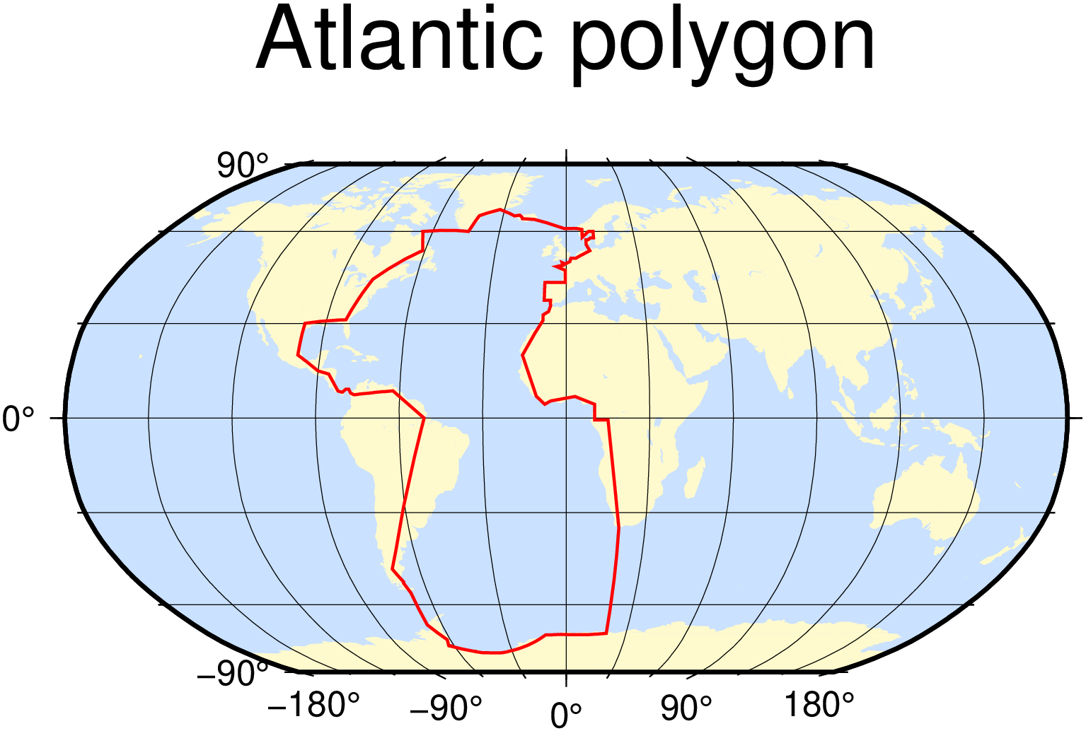
is the Atlantic basin, plotted via
julia
coast(region=:d, proj=:Robinson, frame=:g, res=:crude, area=10000, land=:lemonchiffon1, water=:lightsteelblue1, figsize=12)
x = [P.lon for P in OCEANS[85].polygon] # Atlantic is 85th
y = [P.lat for P in OCEANS[85].polygon]
plot!(x,y, lw=1, lc=:red, title="Atlantic polygon", show=true, savefig="ATL.png")
Owner
- Name: Benoît Pasquier
- Login: briochemc
- Kind: user
- Location: Sydney, Australia
- Company: UNSW
- Website: https://www.bpasquier.com/
- Repositories: 157
- Profile: https://github.com/briochemc
Research Associate at UNSW
GitHub Events
Total
- Create event: 1
- Commit comment event: 2
- Release event: 1
- Watch event: 1
- Issue comment event: 1
Last Year
- Create event: 1
- Commit comment event: 2
- Release event: 1
- Watch event: 1
- Issue comment event: 1
Committers
Last synced: about 2 years ago
Top Committers
| Name | Commits | |
|---|---|---|
| Benoit Pasquier | b****c@g****m | 25 |
| github-actions[bot] | 4****] | 1 |
Issues and Pull Requests
Last synced: over 1 year ago
All Time
- Total issues: 3
- Total pull requests: 2
- Average time to close issues: 1 day
- Average time to close pull requests: about 2 months
- Total issue authors: 2
- Total pull request authors: 1
- Average comments per issue: 2.0
- Average comments per pull request: 0.0
- Merged pull requests: 2
- Bot issues: 0
- Bot pull requests: 2
Past Year
- Issues: 0
- Pull requests: 1
- Average time to close issues: N/A
- Average time to close pull requests: 4 months
- Issue authors: 0
- Pull request authors: 1
- Average comments per issue: 0
- Average comments per pull request: 0.0
- Merged pull requests: 1
- Bot issues: 0
- Bot pull requests: 1
Top Authors
Issue Authors
- briochemc (2)
- JuliaTagBot (1)
Pull Request Authors
- github-actions[bot] (3)
Top Labels
Issue Labels
Pull Request Labels
Packages
- Total packages: 1
-
Total downloads:
- julia 1 total
- Total dependent packages: 0
- Total dependent repositories: 0
- Total versions: 11
juliahub.com: OceanBasins
Determine if a (lat,lon) coordinate is in a given ocean basin
- Documentation: https://docs.juliahub.com/General/OceanBasins/stable/
- License: MIT
-
Latest release: 0.1.10
published over 1 year ago
Rankings
Dependencies
- JuliaRegistries/TagBot v1 composite
- actions/cache v1 composite
- actions/checkout v4 composite
- julia-actions/julia-buildpkg latest composite
- julia-actions/julia-runtest latest composite
- julia-actions/julia-uploadcodecov latest composite
- julia-actions/setup-julia v2 composite
- actions/cache v1 composite
- actions/checkout v4 composite
- julia-actions/julia-buildpkg latest composite
- julia-actions/julia-runtest latest composite
- julia-actions/julia-uploadcodecov latest composite
- julia-actions/setup-julia v2 composite
- actions/cache v1 composite
- actions/checkout v4 composite
- julia-actions/julia-buildpkg latest composite
- julia-actions/julia-runtest latest composite
- julia-actions/julia-uploadcodecov latest composite
- julia-actions/setup-julia v2 composite