https://github.com/datamade/django-geomultiplechoice
🗺 A Django widget to select multiple geographic areas
Science Score: 26.0%
This score indicates how likely this project is to be science-related based on various indicators:
-
○CITATION.cff file
-
✓codemeta.json file
Found codemeta.json file -
✓.zenodo.json file
Found .zenodo.json file -
○DOI references
-
○Academic publication links
-
○Committers with academic emails
-
○Institutional organization owner
-
○JOSS paper metadata
-
○Scientific vocabulary similarity
Low similarity (12.8%) to scientific vocabulary
Keywords from Contributors
Repository
🗺 A Django widget to select multiple geographic areas
Basic Info
- Host: GitHub
- Owner: datamade
- License: mit
- Language: Python
- Default Branch: master
- Size: 3.25 MB
Statistics
- Stars: 6
- Watchers: 3
- Forks: 1
- Open Issues: 4
- Releases: 0
Metadata Files
README.md
🗺 GeoMultipleChoice
A Django widget to select multiple geographic areas.
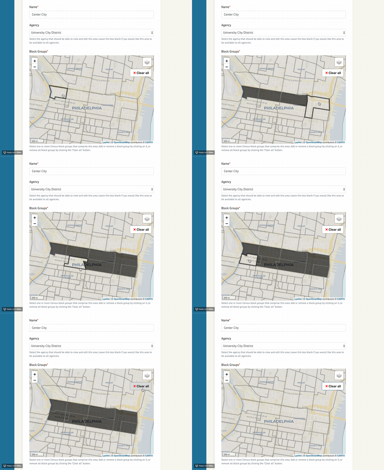
Originally created by @jeancochrane. Packaged up by @beamalsky.
Quick Start
This package is available for installation via PyPI. Simply run:
bash
pip install django-geomultiplechoice
Add it to INSTALL_APPS in your projects settings.py file:
python
INSTALLED_APPS = [
    ...
    'django_geomultiplechoice',
    ...
]
You should now be ready to start widget setup following the documentation below.
Widget options
The example project in this repo contains the following sample form implementation:
```python class ExampleGeoMultipleChoiceForm(forms.ModelForm): class Meta: model = SelectedArea fields = 'all'
def __init__(self, *args, **kwargs):
    super().__init__(*args, **kwargs)

    settings_overrides = {
        'DEFAULT_ZOOM': 12,
        'DEFAULT_CENTER': (41.88, -87.7),
        'RESET_VIEW' : True, # Defaults to True
        # Sets the bounds of RESET VIEW; y min, x min, y max, x max
        # See https://github.com/makinacorpus/django-leaflet/issues/192
        'SPATIAL_EXTENT': (-87.3, 41.5, -88, 42.15),
        'MAP_ID': 'my-example-map', # Defaults to 'map'
        'MAP_HEIGHT': '400px',
        'MAP_WIDTH': '100%',
        'MAP_LAYER_STYLE': {
          'color': '#7a7a7a',
          'weight': 3,
          'opacity': 0.5,
          'fillColor': '#999999',
          'fillOpacity': 0.3,
        },
        'MAP_LAYER_SELECTED_STYLE': {
          'color': '#7a7a7a',
          'weight': 3,
          'opacity': 0.5,
          'fillColor': 'black',
          'fillOpacity': 0.7
        }
    }

    self.fields['areas'].widget = GeoMultipleChoiceWidget(
        choices=[
            (choice.id, choice) for choice
            in Area.objects.all()
        ],
        settings_overrides=settings_overrides
    )
```
settings_overrides accepts all arguments used by django-leaflet in its LEAFLET_CONFIG, in addition to the following:
DEFAULT_ZOOMandDEFAULT_CENTERare required.MAP_IDsets the htmlidfor your widget map. Useful if you have multiple maps on the page.MAP_HEIGHTandMAP_WIDTHallow you to size the widget in your form. Must be used together.- This example uses the default values for
MAP_LAYER_STYLEandMAP_LAYER_STYLING.
SelectedArea is a model defined in example/models.py, and can be adjusted for your needs.
Importing Census data
This repo includes an example application using geographical data for 2018 Census block groups in Chicago. Look at data/Makefile and management/commands/import_data.py to see the ETL pipeline for that data.
If you'd like to use the same pipeline in your project but for a different area:
- Copy the
datadirectory into your project - Update
STATESinscripts/states.py. If the area is in a new state, create a new entry in STATES for that state; otherwise, update the existing state. - Update
allindata/Makefileto match the form$(DATA_DIR)/final/cb_2018_{state id}_bg_500k.shpfor each state you're importing shapefiles for. - To delete and regenerate the shapefiles, run:
bash
cd data && make clean && make
Or if your app is containerized:
bash
docker-compose run --rm app make clean -f example/data/Makefile
docker-compose run --rm app make -f example/data/Makefile
- Run
python manage.py import_datato import the new geographical data. Or if your app is containerized, rundocker-compose run --rm app python manage.py import_data
Changing the data structure
Though the example implementation of this widget uses Census block groups, we've intentionally left the door open to varied geographic data. By default the widget expects each area to have the attributes in example.models.Area:
python
class Area(models.Model):
    id = models.CharField(max_length=12, primary_key=True)
    geom = geo_models.MultiPolygonField(srid=4269)
If that structure doesn't work for you, it can be changed through creating a new widget that inherits from django_geomultiplechoice.widgets.GeoMultipleChoiceWidget and modifying get_features().
Local development
This app requires Docker and Docker Compose for local development.
To install and get started, run the following commands in your shell:
```
Clone the repo
git clone git@github.com:datamade/django-geomultiplechoice.git
Move into the folder
cd django-geomultiplechoice ```
Then build and run the app with Docker:
bash
docker-compose up --build
You'll also need to import the Census data into your database, for which we've provided a sample import_data.py. Open a new window in your terminal and run:
bash
docker-compose run --rm app python manage.py import_data
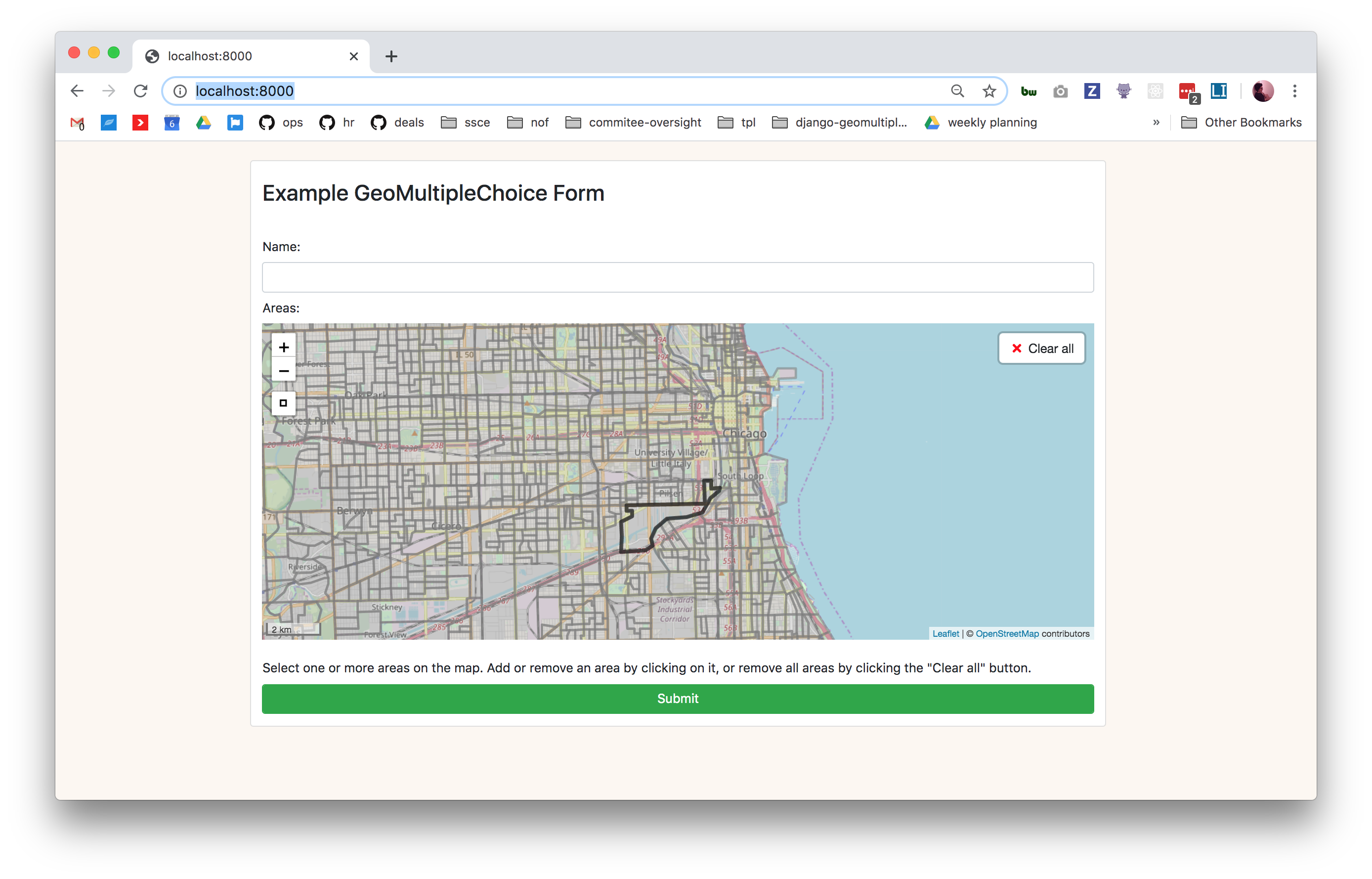
Visit http://localhost:8000/ and you should see the example form running!
Cleaning up
To remove data files, run:
bash
docker-compose run --rm app make clean -f example/data/Makefile
To regenerate the Census shapefiles, run:
bash
docker-compose run --rm app make -f example/data/Makefile
To tear down the app and its volumes, run:
bash
docker-compose down --volumes
Owner
- Name: datamade
- Login: datamade
- Kind: organization
- Email: info@datamade.us
- Location: Chicago, IL
- Website: http://datamade.us
- Twitter: datamadeco
- Repositories: 123
- Profile: https://github.com/datamade
We build open source technology using open data to empower journalists, researchers, governments and advocacy organizations.
GitHub Events
Total
- Watch event: 1
Last Year
- Watch event: 1
Committers
Last synced: about 1 year ago
Top Committers
| Name | Commits | |
|---|---|---|
| beamalsky | b****y@g****m | 41 |
| dependabot[bot] | 4****] | 1 |
Issues and Pull Requests
Last synced: about 1 year ago
All Time
- Total issues: 7
- Total pull requests: 11
- Average time to close issues: 5 days
- Average time to close pull requests: about 1 month
- Total issue authors: 2
- Total pull request authors: 2
- Average comments per issue: 0.57
- Average comments per pull request: 0.91
- Merged pull requests: 7
- Bot issues: 0
- Bot pull requests: 5
Past Year
- Issues: 0
- Pull requests: 0
- Average time to close issues: N/A
- Average time to close pull requests: N/A
- Issue authors: 0
- Pull request authors: 0
- Average comments per issue: 0
- Average comments per pull request: 0
- Merged pull requests: 0
- Bot issues: 0
- Bot pull requests: 0
Top Authors
Issue Authors
- beamalsky (5)
- fgregg (2)
Pull Request Authors
- beamalsky (6)
- dependabot[bot] (5)
Top Labels
Issue Labels
Pull Request Labels
Packages
- Total packages: 1
-
Total downloads:
- pypi 28 last-month
- Total dependent packages: 0
- Total dependent repositories: 1
- Total versions: 2
- Total maintainers: 2
pypi.org: django-geomultiplechoice
A Django widget to select multiple geographic areas
- Homepage: https://github.com/datamade//django-geomultiplechoice
- Documentation: https://django-geomultiplechoice.readthedocs.io/
- License: MIT License
-
Latest release: 0.0.5
published over 6 years ago
Rankings
Maintainers (2)
Dependencies
- django ==3.0.3
- django-leaflet ==0.26.0
- psycopg2 ==2.8.4
- six ==1.12.0
- actions/checkout master composite
- actions/setup-python v1 composite
- actions/checkout master composite
- actions/setup-python v1 composite
- python 3.7 build
- django-geomultiplechoice latest
- mdillon/postgis latest